
Begin a Clay County Property Lookup
The statewide WV Property Assessment Property Search is the main public door. It opens Clay County parcel and owner data. You can query by Street Name, Owner Name, or Full Parcel ID. Map Number, Parcel, and Sub-Parcel also work. Every field is optional. The state form also layers on Basic, Appraisal/Sales, Advanced, and Prior Ownership views. District and appraisal filters narrow a broad result set. An address is usually the easiest starting point. A root parcel ID gives the most precision once you have it.
- Choose Clay County and search the situs address or street name in WV Property Assessment Search.
- Open the matching result and copy the Current Owner, root parcel ID, district, map, and parcel fields.
- Use the parcel ID or owner as a key to ask the County Clerk for the latest deed reference.
- Compare the physical address in the Property Viewer with the assessor's Property Address and any mailing address.
- Request a clerk copy or assessor correction through the custodian when the online result lacks the needed detail.
Clay County Search Field Guide
Filters cover appraisal, sales, acreage, buildings, and legal descriptions. Every field on the form is optional. The exact Clay district menu loads only after county selection, so read the values in the live form instead of carrying over a code from another county.
| Field | Type | How it narrows a Clay County search |
|---|---|---|
| County, District | Dropdowns | Select Clay County, then a district if known |
| Full Parcel ID | Text | Find the exact root parcel ID |
| Owner Name, Street Name | Text | Search a named owner or property street |
| Map Number, Parcel, Sub-Parcel | Text | Search parts of the parcel reference |
| Property Class, Tax Class | Dropdowns | Limit by property or tax classification |
| Min/Max Land, Building, Total Appraisal | Numeric ranges | Filter appraisal amounts |
| Min/Max Calculated Acres, Deeded Acres | Numeric ranges | Separate GIS acreage from deed acreage |
| Min/Max Price, Sale From/Through | Price and date | Narrow sale-related results |
| Flood Hazard, Mailing Address | Dropdown and text | Use a flood filter or tax-mailing clue |
| Deed Book, Page, Legal Description | Text | Join an assessor result to a recorded instrument |
| Building Year, Structures, Building Area | Numeric ranges | Filter building details |
| Lines per Page and Display Options | Control and checkboxes | Show legal descriptions or GIS IDs in results |
The portal also provides CSV Results, a Query URL, and pagination. It also links out to any selected parcel. Those tools help you keep a trail. They do not add deed images to the assessment site, so plan on the recorder for instrument copies. The WV Property Assessment form holds the live Clay fields.
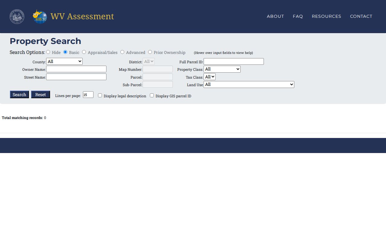
A first search can stay broad. Record the root parcel ID from the result before adding filters or heading to the deed index.
What a Clay County Result Card Holds
A search result is a parcel-card snapshot from the assessment system. Owner, situs, and root ID anchor it. Beyond those, the card carries county and district, map and parcel, the Map Link, the Flood Tool, deeded acres, property class, land-use code, tax class, and land, building, and total appraisal figures. One caution matters. Do not read a mailing address as the situs. The physical parcel and the address used for tax notices can be different places.
| Current Owner | The assessment roll's owner name |
|---|---|
| Property Address | The situs or physical location returned |
| County, District, Map, Parcel | Parts of the parcel reference |
| Root Parcel ID | Six-part state ID used to join records |
| Deeded Acres | Area attributed to the deed |
| Class, Land Use, Tax Class | Assessment classification fields |
| Land, Building, Total Appraisal | Separate appraisal amounts |
| Map Link and Flood Tool | Links for viewer context |
The sample assessment results return ninety statewide matches across six pages. That is not a Clay-specific parcel card. Use it to learn the statewide result columns, not as proof about a Clay property, since the card certifies no title, shows no full lien picture, and replaces no survey. A tax-roll name is an owner-of-record clue. The deed, not the card, identifies the transfer instrument.
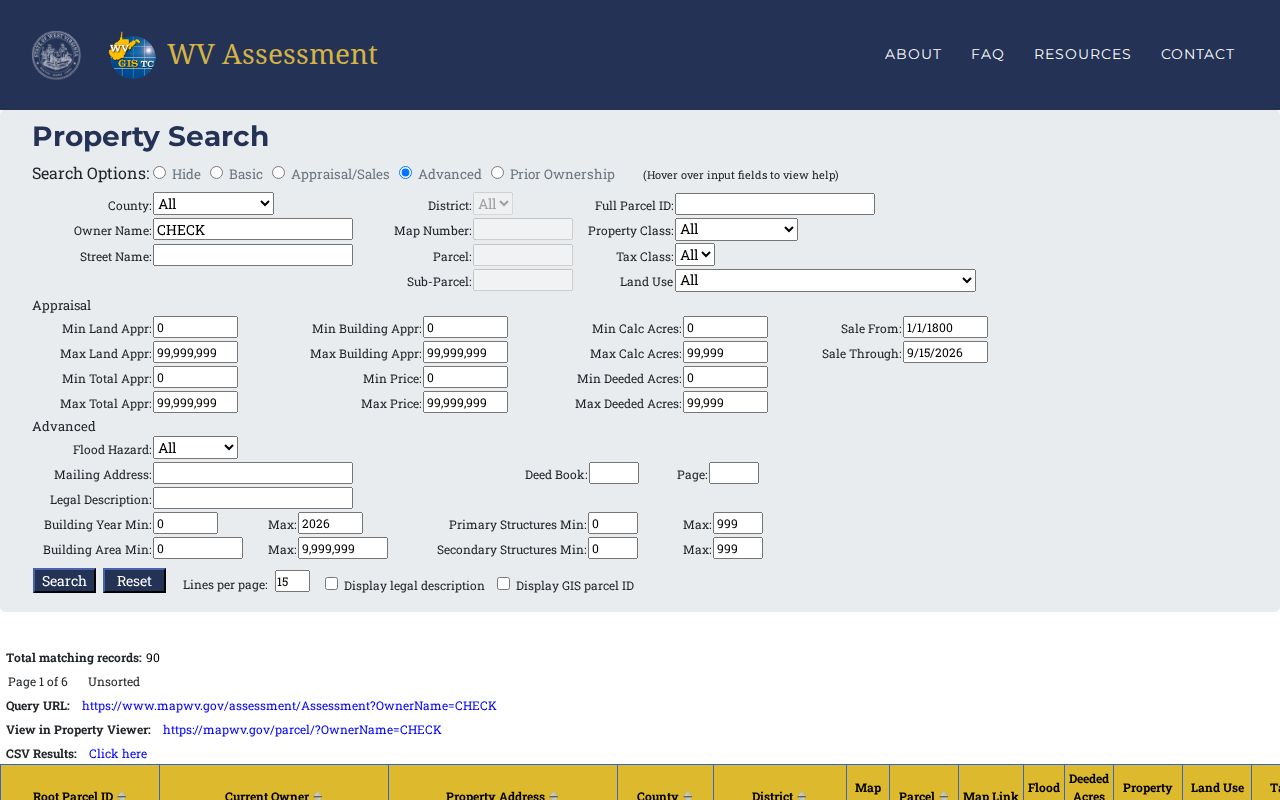
Request the original record by root ID and deed reference.
Choose a Clay County Search Key
Address, owner, and parcel searches each behave differently in Clay County. Addresses trip first. A rural route, an older address, a State Route 16/Main Street label, or a mailing address may not match the assessor's Property Address exactly. Owner names bring noise too. One name can return several parcels and merge different people, so the root ID becomes the best repeat key after a first match.
| Search Key | Best For | Where It Works | Watch Out |
|---|---|---|---|
| Address | Locate a known site | Assessment Search and Property Viewer | Postal, E-911, or situs wording may differ |
| Owner name | Find parcels tied to a person or entity | Assessment Search, then clerk index | Trusts, LLCs, initials, and same-name owners |
| Parcel ID | Repeat an exact parcel match | Assessment Search, GIS, and clerk references | Root, GIS, and CAMA/IAS formats differ |
Not a title search. A Clay County property search locates public records, but it does not establish clear title or prove that no unrecorded interest exists. A title professional reviews the chain and related instruments.
Clay County Situs and Mailing Addresses
The result's Property Address describes where the parcel sits. The advanced search also carries a Mailing Address field. That field can point to an owner who receives tax notices somewhere else entirely. Keep the two values in separate notes. Never assume the mailing location is a house on the parcel, and never treat a postal city as proof of town limits.
Clay sits along the Elk River, with State Route 16 serving as Main Street. A modern source may use the road name while an older deed names the river, a creek, a ridge, or an adjoining tract. For a rural address, try the street wording first. Then confirm the land through the assessor's district, map, and parcel fields plus the deed description.
The USPS lookup handles street-address, city/state, and ZIP searches. A ZIP result proves neither occupancy nor boundary.
Reading a Clay County Root Parcel ID
A Clay County root parcel ID strings together several coded parts. It moves from a numeric county code into a district code. Then comes a map number, a parcel prefix, a parcel suffix, and a special ID. A statewide example can show the general shape. But Clay's own county and district values come from the live parcel dropdown. Pull the real Clay result. Treat that only as a pattern, never as a local code.
The GIS Parcel ID trims the special ID off the end. The CAMA/IAS form leaves out the county code, and abbreviated results may shrink to district-map-parcel. Save the ID exactly as the system returns it. Then store the deed book and page plus the legal description beside it. The parcel ID works as a search key. The recorded instrument and its description define what was actually conveyed.
Clay County Rural Legal Descriptions
Some Clay County land hides from a street search. The deed description finds it. Older transfers may call out a stream, a ridge, a hollow, an adjoining owner, a farm, an acreage figure, or a metes-and-bounds course. A modern street search can miss the record when the route wording changed or the parcel carries no familiar situs label.
The assessment form helps. It includes Deed Book, Page, and Legal Description fields plus Display Legal Description and Display GIS Parcel ID options, all cross-references rather than substitutes for the recorded deed. The deed itself still governs. If the first search fails, ask the Assessor whether another situs, owner, or parcel form appears on the card. Then ask the Clerk about the legal description.
Open a Clay County Parcel in GIS
After a search result comes back, open the linked parcel in the WV Property Viewer. The record shows the physical address, community and E-911 fields, and a highlight of the parcel on the GIS map. Flood context sits alongside it. An assessment report link sits there too. The map panel reveals a parcel's details, while the wider map helps you compare nearby lot geometry. Three tools do most of the work here. Highlight isolates one parcel. Copy Link preserves your map state, and Download KMZ exports a GIS item you can keep.
Remember that the viewer is not the whole record. Follow its assessment link for the tax card, and pull a recorded plat whenever lot, block, road, or subdivision detail matters. A tax parcel image is never a survey. For a Clay County property search, the map is a fine way to orient yourself before making a precise request at the clerk's counter. The WV Property Viewer carries all of these parcel tools.
Treat the selected parcel as a map reference only. Its deeded area and boundaries still live in the land records. The Clay County parcel maps page explains where the viewer's boundary lines stop being authoritative.
Search LLCs and Similar Owner Names
An owner-name result in Clay County property records might be an individual. It could also be a trust, an estate, a corporation, or an LLC. Copy the punctuation and abbreviations exactly as the result shows them. Two similar names might look like the same party. Check the grantee line on the deed itself before you decide. An LLC record can tell you its legal status and registered agent. That still does not replace the parcel deed.
The WV Secretary of State basic entity search takes an organization name. Its detail view can list entity type, city, status, and address. It may also show registration number, creation date, and registered agent. The advanced form goes further. It adds agent or officer, record ID, street, city, county, state, and organization type. Use it as a secondary clue. It helps with entity names that surface in a Clay County property search. The WV Secretary of State business search is free to view. A certificate of existence carries a separate fee.
When Clay County Search Data Is Behind
A recorded closing can land in the County Clerk's books early. A simple ownership change may not reach the statewide annual assessment release as quickly. The state FAQ notes that new parcel lines can also lag. That delay can stretch past the next submission cycle. If your current search still shows the seller, take the latest deed recording date. Treat the book/page as the newer clue. Then call the Assessor about the card's update.
Clay County publishes no current web index cutoff for deeds. There is no live local tax-bill interface either. A missing result does not mean the record is missing. The fallback is always the custodian. The County Clerk holds deeds and plats. The Assessor keeps the parcel card. The Sheriff handles tax tickets. Court material requires a courthouse request.